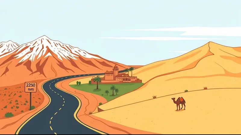
The road from Marrakech to Merzouga is roughly 560 km and takes about 9-10 hours of driving, and along the way you cross the High Atlas at the Tizi n'Tichka pass (2,260 m on the summit sign), reach the UNESCO ksar of Ait Ben Haddou, pass through Ouarzazate, and follow the palm groves of the Draa valley before the Erg Chebbi dunes rise near Merzouga. These are not detours. Most 3-day desert tours from Marrakech follow this exact corridor, and Ait Ben Haddou, Ouarzazate and the Draa are the main scheduled stops, not optional side trips.
So when people ask what there is to "see" on this drive, the honest answer is: the drive itself is the sightseeing. You move from snow-dusted mountain passes to earthen fortresses to date-palm oases in a single day. This guide breaks the route down leg by leg, so you know what is coming and why operators split it across two or three days.
What do you actually see on the road from Marrakech to Merzouga?
You see three distinct landscapes stitched together: high mountains, pre-Saharan clay architecture, and river oases. Leaving Marrakech, the road climbs into the High Atlas and crosses the Tizi n'Tichka pass. On the far side sits Ait Ben Haddou, a fortified earthen village listed by UNESCO, followed by Ouarzazate with its film studios. From there the Draa valley unrolls south as a green ribbon of palm groves, ksour and kasbahs, before the route swings east toward the Erg Chebbi dunes at Merzouga.
The key point for planning: Ait Ben Haddou and the Draa valley are the road, and Erg Chebbi is the destination. Almost every shared or private tour on the 3-day Marrakech to Merzouga route uses these same stops, because there is essentially one main paved corridor south. You are not choosing between them — you get all of them.
How long is the drive from Marrakech to Merzouga and how is it broken up?
The full distance is roughly 560 km, which is about 8-9 hours of pure driving and closer to 10 or more once you add photo stops, lunch and the mandatory Ait Ben Haddou visit. It is a long day by any standard, which is why almost no one does it non-stop.
The route splits naturally into legs:
- Marrakech to Ait Ben Haddou — roughly 4 hours, including the Atlas crossing.
- Ait Ben Haddou to Ouarzazate — about 30 km, half an hour.
- Ouarzazate down the Draa valley toward Zagora — the classic scenic segment of oases and kasbahs.
- East to Merzouga — the longest final push, through Tinghir or the Rissani plain to the dunes.
Most operators break this across 2-3 days precisely because the driving is heavy and the light is best in the early morning and late afternoon. A two-day Zagora loop stays shorter and closer; the three-day Merzouga tour goes all the way to Erg Chebbi. If you are weighing the two, the 2-day Zagora vs 3-day Merzouga comparison lays out the trade-off in distance and time.
Why does the road cross the Tizi n'Tichka pass and how high is it?
The road crosses Tizi n'Tichka because it is the main paved gateway through the High Atlas on National Route 9 — there is no flat way around this mountain wall. The summit sign reads 2,260 m, while a 2022 GPS measurement puts the true saddle at about 2,205 m, making it the highest paved mountain pass in Morocco.
The ascent is a long series of switchbacks. You will pass small Berber villages clinging to the slopes, roadside stalls selling argan oil, walnuts, amethyst and fossils, and viewpoints where the valleys drop away sharply below. In recent years the road has been widened and partly rerouted in stages (works carried out in recent years), which has smoothed some of the tightest bends and shortened travel time compared with the old single-lane sections. It is still a mountain drive, though — expect a slower pace here than the distance alone suggests. Morocco's official tourist board describes this stretch through the High Atlas and Ouarzazate region as one of the country's signature overland routes.
What is Ait Ben Haddou and why is it a UNESCO World Heritage Site?
Ait Ben Haddou is a fortified earthen village, or ksar, built on a hillside above the Ounila river, roughly 30 km northwest of Ouarzazate. UNESCO inscribed it on the World Heritage List in 1987 as one of the most complete surviving examples of southern Morocco's pre-Saharan clay (pisé) architecture.
Physically, the site is a cluster of kasbahs and houses packed inside defensive walls, rising in tiers toward a communal granary at the very top of the hill. The buildings are made of rammed earth and mud brick, which is why they need constant maintenance — rain slowly erodes the walls, and restoration is more or less continuous. A handful of families still live inside the old ksar, while most residents have moved to the modern village across the river. You cross the riverbed (usually low or dry) to reach the entrance and climb up through the lanes to the granary for the wide view over the palm-fringed valley. The full inscription details are on UNESCO's official listing for Ait Ben Haddou.
Which films were shot at Ait Ben Haddou and Ouarzazate?
Ait Ben Haddou and the nearby Atlas Studios in Ouarzazate have hosted a long list of international productions, including Lawrence of Arabia, Gladiator, Kingdom of Heaven, Prince of Persia and Game of Thrones. Ouarzazate is nicknamed "the door of the desert" and has grown into Morocco's main filmmaking hub.
The reason crews keep coming back is practical rather than glamorous. The clay architecture reads on camera as ancient and placeless — it can stand in for Jerusalem, Egypt, Persia or an invented city — and the high-desert light is strong and consistent for much of the year, which simplifies shooting schedules. Ouarzazate has purpose-built studios with standing sets, plus a large pool of local extras and crews. You do not need to book a studio tour to appreciate this; standing in the ksar, you can see immediately why it doubles for so many places.
What is the Draa valley and how long is the Draa river?
The Draa (also spelled Drâa) is Morocco's longest river, and the Draa valley is the corridor of date-palm oases, ksour and kasbahs that follows it south from Ouarzazate. For long stretches the river runs underground or dries to a trickle, but the water sustains a near-continuous belt of palm groves that stands out vividly against the surrounding rock and hamada.
The classic scenic segment is the stretch from Ouarzazate to Zagora. The town of Agdz marks the point where the road drops into the first serious palm groves, and from there the greenery rarely lets up until Zagora. This is where the drive stops feeling like a mountain crossing and starts feeling like the edge of the Sahara.
What are the main stops in the Draa valley between Ouarzazate and Zagora?
The main stops, in order heading south, are Agdz, the Kasbah of Tamnougalt, the palmeraie itself, and Zagora with its caravan sign:
- Agdz — the gateway to the palm groves and a common tea or lunch stop.
- Kasbah of Tamnougalt — just a few kilometres past Agdz, a historic fortified village you can walk through.
- The palmeraie and pottery villages — the green heart of the valley between Agdz and Zagora, dotted with small oasis settlements.
- Zagora — home to the well-known Timbuktu caravan road sign, a reminder that this was once a real caravan departure point.
On a three-day Merzouga tour you usually only skim this stretch, because the route bends east before Zagora. On a dedicated two-day Zagora tour, the valley itself is the main event.
When is the best time of year to drive this route?
Spring (roughly March to May) and autumn (roughly September to November) are the most comfortable, with mild daytime temperatures across both the mountains and the desert. These shoulder seasons avoid the two extremes that shape this drive.
In summer, the Draa valley and the Merzouga area regularly climb above 40°C, and on the open sand it can pass 45°C — draining if you are spending hours in a vehicle and walking around kasbahs at midday. In winter the opposite risk appears: the Tizi n'Tichka pass can see snow, ice and occasional temporary closures, which can disrupt or reroute the Atlas crossing. Merzouga winters are mild by day (around 19°C) but cold at night (around 6°C, colder on the dunes). Season affects both comfort and whether the road is fully open, so it is worth checking conditions before a winter departure. For a fuller seasonal breakdown, see our guide to the best time to visit the Sahara desert.
How does the road reach the Erg Chebbi dunes at Merzouga?
From the Draa valley the route turns east, threading through Tinghir and the Todra gorge area or across the Rissani plain, before arriving at Merzouga, where the Erg Chebbi dunes rise up to about 150 m above the flat hamada around them. This final leg is the longest single driving day on most three-day itineraries, which is why tours usually reach the dunes in the late afternoon, in time for the walk or camel ride to a desert camp.
This is the moment the geography clicks into place. Everything before — the Atlas pass, Ait Ben Haddou, the Draa palm groves — is the road. Erg Chebbi is the destination. The dunes appear abruptly out of a stony plain, which is part of why they feel so distinct from everything you crossed to get there.
Can you visit Ait Ben Haddou and the Draa valley on a tour, or self-drive?
You can do either, and the right choice depends on how much long-distance mountain driving you want to handle yourself. Organised 2-3 day shared or private tours bundle the driving, the fuel, the Ait Ben Haddou stop and the desert camp into one package, so you sit back and watch the landscape change. Self-drive car rental gives you full flexibility over timing and stops, but it means several hours of Atlas switchbacks, navigation and parking in busy towns — manageable for confident drivers, tiring for everyone else.
A middle path is a private driver, which keeps the flexibility of self-drive without you being at the wheel. If you are comparing formats, the private vs shared tour guide explains the differences in pace and cost. For live prices, ratings and departure options, check the tour pages themselves — those numbers appear only in the booking widgets and change constantly, so it would be dishonest to quote fixed figures here.
If this route sounds like your kind of trip, the practical next step is to compare the actual departures on the 3-day Sahara tour from Marrakech to Merzouga page, where current prices and reviews are shown side by side.
Frequently asked questions
Is Ait Ben Haddou worth stopping at?
Yes. It is a UNESCO World Heritage Site (inscribed in 1987) and sits directly on the main route, so stopping adds little detour. It is one of the best-preserved examples of southern Moroccan earthen ksar architecture and takes roughly an hour to explore.
How far is Ait Ben Haddou from Marrakech?
Roughly 4 hours by road, because the drive includes the Tizi n'Tichka mountain crossing rather than flat highway.
Do you need a 4x4 for this route?
No. The entire Marrakech-Ouarzazate-Draa corridor follows the paved National Route 9 and other sealed roads. A normal car handles it. A 4x4 is only needed for off-road excursions onto the dunes near Merzouga, which the camps and operators arrange separately.
How high is the Tizi n'Tichka pass?
The summit sign reads 2,260 m, while a 2022 GPS measurement gives about 2,205 m. Either way it is the highest paved mountain pass in Morocco.
Is one day enough to reach Merzouga?
It is physically possible — about 560 km and 9-10 hours of driving — but it is a very long day with no time to enjoy the stops. Two to three days is the standard and far more comfortable recommendation.
How hot does the Draa valley get in summer?
Summer daytime temperatures regularly exceed 40°C in the Draa valley and around Merzouga, and can pass 45°C on the open sand. Spring and autumn are much milder.